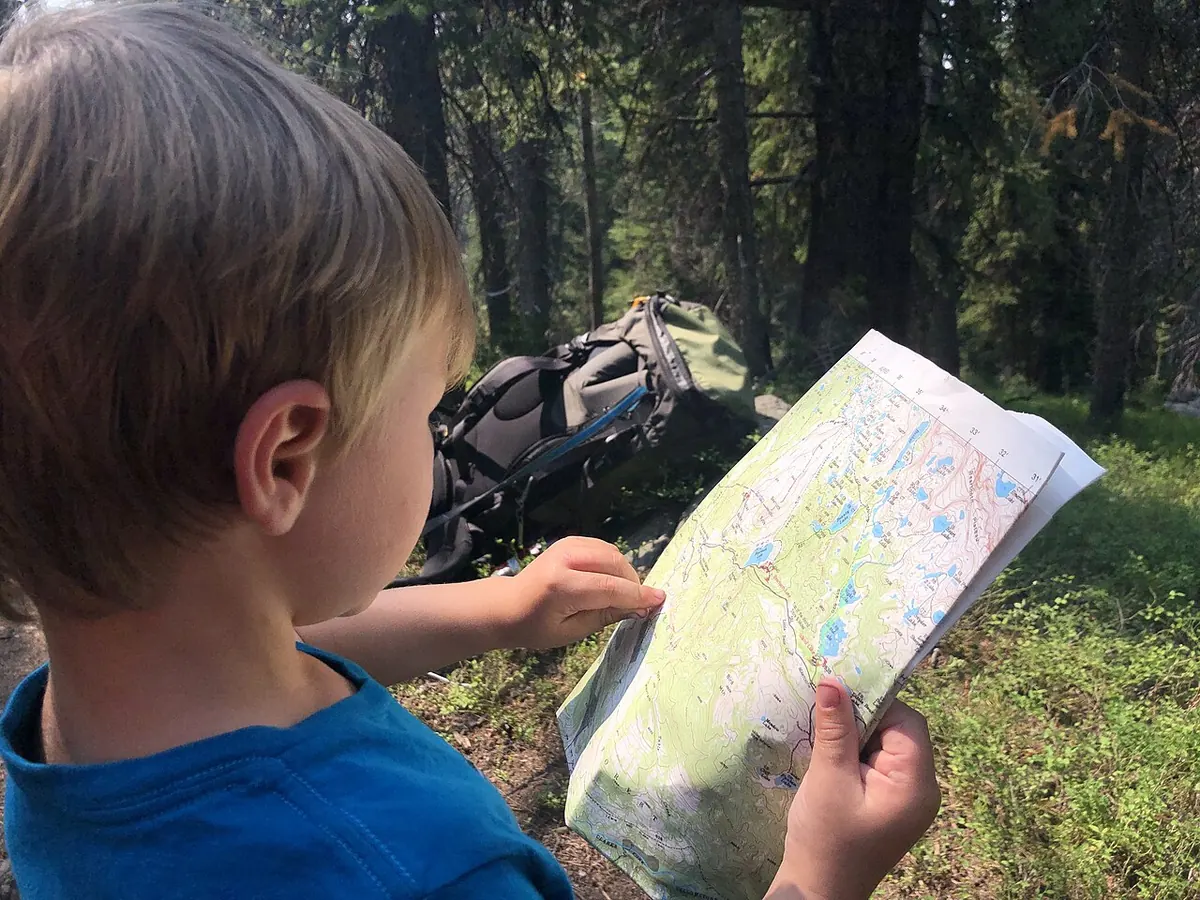
 Photo Forest Service, Northern Region, Public domain

Reading a topo map
Seeing hills, valleys and bogs in the brown lines, and knowing how far a centimetre really is.
What you need
- A topographic map of the area, 1:50,000 is the common Canadian sheet
- A clear waterproof map case or a zip bag
- A baseplate compass with a ruler on the edge
- A pencil
How
- Read the margin first: the scale, the contour interval, the date and the magnetic declination.
- Learn the scale. On a 1:50,000 map, 2 cm is 1 km, and each grid square is 1 km across.
- Each brown contour line joins ground of the same height. The thick ones, index contours, carry the height number.
- Lines close together mean steep ground. Lines far apart mean flat or gentle ground.
- A circle of lines is a hill. The smallest ring is the top.
- Where contour lines cross a stream they make a V or a U. The point of the V always aims uphill, upstream.
- Blue is water, green is woods, white is open ground. Little tufts of blue grass marks are bog, and on the Island that is a lot of the map.
- Turn the map so north on the map lines up with north on the ground. Now what is on your left on the map is on your left in the woods.
- Set the declination on your compass, or add it by hand. On the Island it is well over fifteen degrees west, and more in Labrador. Take the number from the margin and allow for the year.
Do and don't
Do
- Follow your progress on the map as you walk, so you always know where you are within a square.
- Use big features to check yourself: a pond, a river bend, a ridge.
- Carry the map where you can get at it without taking the pack off.
Don't
- Do not trust an old map on trails, roads and cabins. Land and water hold, the rest changes.
- Do not ignore declination here. Twenty degrees off over a few kilometres puts you in the wrong valley.
- Do not rely on a phone alone. Carry the paper sheet too.
Watch for
Danger
- Bog shown as open ground on a map can be waist deep. Walk the edges and test with a pole.
- A map case left open in the rain ruins the map in an hour.
- Contours hide small cliffs between the lines. Ground that looks steep on the map is steeper on foot.
Notes
Canadian topo sheets are the NTS series, free to download from Natural Resources Canada and easy to print at the size you want.
Spend an evening at the table with the map of a place you know well. Once the lines turn into hills in your head, every other map reads the same way.
Updated 2026-09-21
Related
 Taking and walking a bearing
Navigation
Map and compass to a place you cannot see from where you stand.
 Aiming off and catching features
Navigation
Missing your target on purpose so you know which way to turn, and picking a line on the map that tells you when you have gone too far.
 Pacing and judging distance
Navigation
Knowing how far you have walked by counting your steps and watching the clock, so the map and the ground stay matched.
 GPS and phone navigation
Navigation
Using a phone or a GPS in the woods with no signal: maps saved before you go, battery kept alive, and the paper map still in the pack.